Note: Map shows the area with a shake intensity of 3 or greater, which U.S.G.S. defines as “weak,” though the earthquake may be felt outside the areas shown. All times on the map are Pacific time. The New York Times
A 4.3 earthquake struck in the San Francisco Bay Area on Monday, according to the United States Geological Survey.
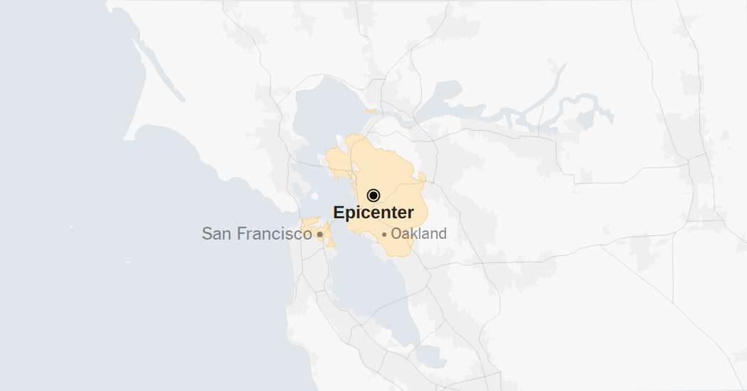
The temblor happened at 2:56 a.m. Pacific time about 1 mile southeast of Berkeley, Calif., data from the agency shows.
U.S.G.S. data earlier reported that the magnitude was 4.6.
The earthquake was an unwelcome alarm for many Bay Area residents, who were jolted out of bed in the middle of the night and remained awake for some time as they braced for aftershocks. Phones also blared with a warning to find shelter.
Though the magnitude of the temblor was not severe, it was centered in one of the most heavily populated areas of the Bay Area.
Bay Area Rapid Transit slowed its trains at the start of the Monday morning commute to conduct safety track inspections, the system said in an alert. It warned riders that they could experience delays of up to 20 minutes.
As seismologists review available data, they may revise the earthquake’s reported magnitude. Additional information collected about the earthquake may also prompt U.S.G.S. scientists to update the shake-severity map.
Aftershocks in the region
An aftershock is usually a smaller earthquake that follows a larger one in the same general area. Aftershocks are typically minor adjustments along the portion of a fault that slipped at the time of the initial earthquake.
Quakes and aftershocks within 100 miles
Aftershocks can occur days, weeks or even years after the first earthquake. These events can be of equal or larger magnitude to the initial earthquake, and they can continue to affect already damaged locations.
When quakes and aftershocks occurred
Source: United States Geological Survey | Notes: Shaking categories are based on the Modified Mercalli Intensity scale. When aftershock data is available, the corresponding maps and charts include earthquakes within 100 miles and seven days of the initial quake. All times above are Pacific time. Shake data is as of Monday, Sept. 22 at 6:18 a.m. Eastern. Aftershocks data is as of Monday, Sept. 22 at 1:26 p.m. Eastern.
Maps: Daylight (urban areas); MapLibre (map rendering); Natural Earth (roads, labels, terrain); Protomaps (map tiles)
Copyright for syndicated content belongs to the linked Source link


